Karlsruhe
State of the Map Europe 2014 was in the German city of Karlsruhe. The city was a planned city – designed and built around 1715 – pre motor car, but with wide avenues, and half of the city seems to be a park. It’s also famous for being the home of the Karlsruhe Addressing Scheme – an example of a folksonomy tagging convention that everyone pointed to and adopted, due to the great mappers there – including the folks from Geofabrik.de who also organised the conference. Here are some notes from the conference:
Nature of the conference
The European conference seemed much more intimate with a focus on developer and contributors – compared to the US Conference which I think had more end users and people sent there by their bosses for their company. Pretty much every single session was on topic (except for the closing buzzword laden keynote!) – and as such there were no enlightening talks about psychogeography, general historical mapping, or other geospatial software. It was pure OSM.
All the talks are online and the video recordings are on youtube and I encourage you to view them.
3D maps
3D Maps, such as Mapzen and OSMBuildings were prominent – and both showed off some very creative ways of representing 3D maps.
Geocoder and Gazetteers
The only track in the conference – this was full of gazetteers with an announcement from OpenCage and MapZen – all appear to be using ElasticSearch – same as we (Topomancy) did last year for the NYPL and Library of Congress. Check out gazetteer here.
Other stuff
Trees – Jerry did a talk about mapping trees – about how they were represented in historical maps previously, and how we can use SVG symbols to display woods and trees in a better way. Jerry lead an expedition and workshop on the morning of the hack day to show participants the different habitats, surface types and variance in the environment that mappers could take into consideration.
Mapbox WebGL – Constantine, a European engineer of Mapbox did a fascinating talk about the complexities of the technical challenges with vector tiles and 3D maps. I really enjoyed the talk.
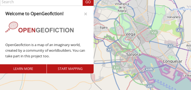
OpenGeoFiction – using the OSM stack to create fictional worlds – not fantasy or science fiction, but amazing experiments in amateur planning, utopian visions and creative map making. OpenGeoFiction.net
The fictional world of Opengeofiction is thought to be in modern times. So it doesn’t have orcs or elves, but rather power plants, motorways and housing projects. But also picturesque old towns, beautiful national parks and lonely beaches.
I love this project!
Vector Tiles – Andy Allan talked about his new vector tile software solution ThunderForest – being one of the only people to know the ins and outs of how Mapbox do the Mapnik / TileMill vector magic. ThunderForest powers the cycle map. Vector maps has lots of advantages and I think we’d probably use it for OpenHistoricalMap purposes at some stage. Contact Andy for your vector mapping and online cartographic needs!
POI Checker – from the same house as WheelMap.org comes POI Checker – it allows organisations to compare their data with data in OSM – and gives a very neat diff view of Points of Interests. This could be a good project to follow.
Historical Stuff
OpenHistoricalMap There were a few things about historical maps in the conference, although in my opinion less than at any other SOTM previously. I did a lightning talk about OpenHistoricalMap and completely failed to mention the cool custom UK centric version of the NYPL’s Building Inspector.
Opening Keynote – this was peppered with the history of the city and gave a number of beautiful historical map examples. Watch the video.
Map Roulette v2 – Serge gave a talk about the new version of Map Roulette – it is being customised to be able to run almost any custom task on the system. We chatted a the hack day to see if the tasks from the Building Inspector could be a good fit into the new Map Roulette – I will look into this!


There is a typo:
Wrong: “Mapbox WebGL – Constantine, a European engineer”
Right: “Mapbox WebGL – Konstantin, a European engineer”
Pingback: Weekly OSM Summary #98 | OpenStreetMap Blog
Pingback: OSM - Riassunto Settimanale #98 | Nazionlinux
Pingback: 週間OSMサマリ #98 | OpenStreetMap Blog
Pingback: OpenStreetMap Chile » Blog Archive » Resumen Semanal OSM #98