Videos for Friday and Saturday Main Auditorium Sessions.
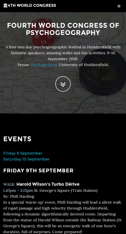
It’s two months since the Fourth World Congress of Psychogeography held in Huddersfield in 2017. The Friday and Saturday sessions in the main auditorium were streamed live and now we are happy to have the recorded videos on VideoHud.
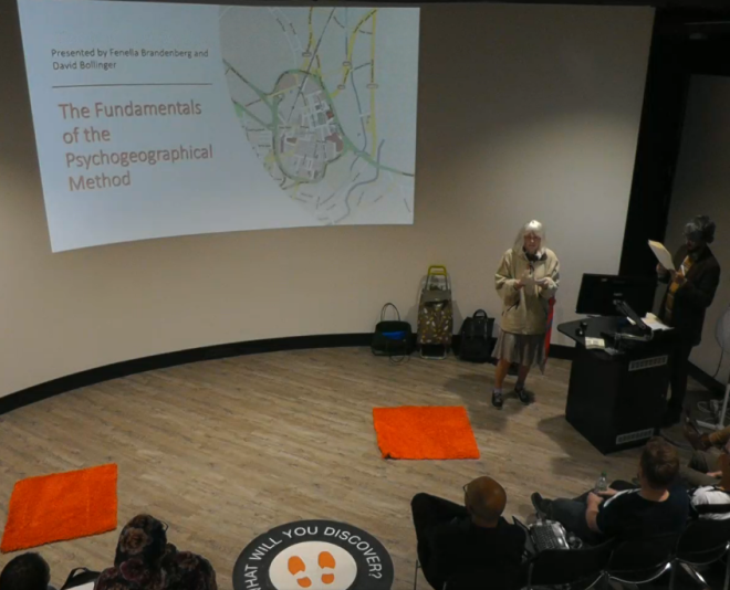
Of special interest is the recording of the controversial Fenella Brandenberg & David Bollinger on Friday morning which many have expressed their wishes to see, and which a few people had trouble hearing on the day.
Note that you can change the camera in the video viewer from slides and main camera (with extra video of the camera of the screen and the computer too) which might be useful for some presentations.
RTE Inside Culture
The Irish national radio station’s RTE 1 Inside Culture show featured the World Congress, interviewing a number of participants and covering a wide range of things, amongst a rather good show about Psychogeography in general. If you were at the Congress you might have met and chatted with Regan, or at least noticed a fella walking around with a large microphone – this is his work!
Sonia Overall, Morag Rose, Gareth Rees, Kevin Boniface and Barbara Lounder were featured, as well as the voices of Graeme Murrell and Dave Smith that I could hear.
The 4wcop specific content starts at 19 minutes, but give it all a listen!
You can find the button to Listen at the end of the Inside Culture page. I think you have a month from Nov 20 2017 to listen to it. Or you can listen to the show here:
For the fifth year running I’ve been co-organizing the series of World Congresses of Psychogeography. You can read up about last years congress here. From 8-10 September in Huddersfield, the Fourth World Congress of Psychogeography http://4wcop.org/ took place. The three days had around 200 people attend, with over forty events from the loony, the jolly, the thoughtful, to the sublime. I led three things, two participations, The Centre and Algorithm Walks and I represented the newly formed West Yorkshire Traipsers in hosting Derive Day. Here is my brain dump of the event as a whole and the things I went to.
Otley Walking Festival – Psychogeographic Sound Walk. Notes from a talk.
For the second year in a run I took part in leading a psychogeography walk for the Otley Walking Festival. The festival runs for a week and has dozens of varied walks from 20 mile hikes up fell and dale, walks looking for cup and ring marks anf from local history walks to walks around allotments, and people’s gardens. I did the “Psychogeographic Sound Walk”. Here is my notes for the introduction for the walk – I expected around half a dozen folks – but we had up to 20 people with a wide range of attendees.
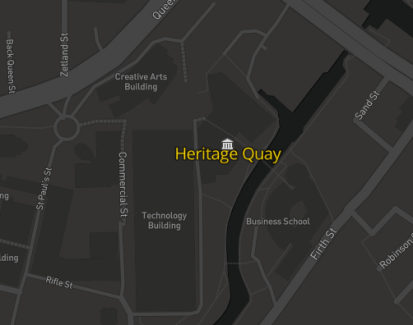
The Fourth World Congress of Psychogeography (4wcop.org) happened a few weeks ago in September and was held at Heritage Quay at the University of Huddersfield. It was organised by Phil Wood (Urban Therapist http://philwood.eu), Alex Bridger (Huddersfield Psychogeography Network and Academic Psychologist the University), Dave Smith (Participation and Engagement Officer at Heritage Quay) and myself. It was much popular than we imagined (or planned for) with 98 people attending with 368 cumulative attendance over two days and eleven events. People came as far afield as Utrecht in The Netherlands, Exeter, London and Birmingham! We didn’t have any external funding but had a little bit from the University and venue for some of the headline speakers. The majority of events, talks and walks were done at no cost, and all events were for free. A few of the events were also promoted and part of the Heritage Open Days (PDF) for Kirklees.
Psychogeography
If this is your first encounter with the topic of psychogeography, here is a quick summary of what it is. I gave this at the beginning of my walks:
Psychogeography is the study of place and people. It’s mainly a practised activity with walking at its core. You can learn three things from doing Psychogeography:
1) You can learn about a place (how it works, what’s there, what it is like).
2) You can learn about spaces and how places in general works (society shaping places, capitalism and cities, consumerism etc)
3) You can learn about yourself (what perceptions do we have, why do we feel this about that, how do we live your life in places, self reflection)
The walk or the “Derive” or drift is the main way people do psychogeography, and I think there are two main ways of moving.
We walk according to our subconscious, we follow our own, or collective desires and let ourselves be drawn and influenced by the spaces we are in. We wander and move according to the spaces we are in. We walk to the places that attract us and away from those that make us anxious. The spaces and places we walk in shape our experiences.
We walk according to random or a rule. We move more consciously into places which our desires may never have taken us. We follow a rule (such as take alternate left and right turns) or at random (for example, a roll of a dice) instead of relying on our own feelings or the feelings of a space.
Both types of walking can give us different things.
4WCOP Website
I developed the website (4wcop.org), using an adapted Bootstrap theme, Grayscale, swapping out the Google Maps API integration and using Leaflet. The code is open source and is also hosted using GitHub pages. A custom Mapbox tile style was developed using the Mapbox Studio online and shows the Heritage Quay venue.
The site had sections for event listing, biographies, an about section and contact sections.
History of the Congress
The name, the Fourth World Congress implied that we had three similar events, however the other ones were various and different. We all liked the self myth making nature of the Situationists, and their colourful descriptions of expulsions and history.
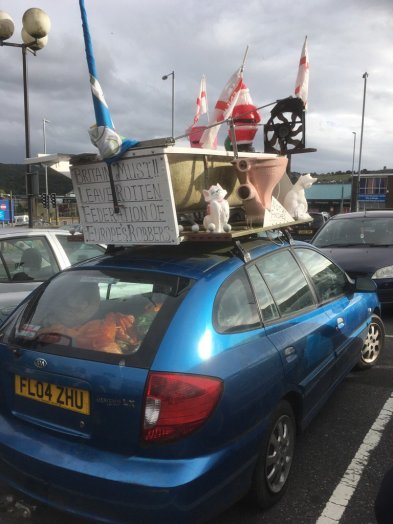
“The First World Congress of Psychogeography took place in June last year (2015) in two locations at the same time – Huddersfield and Leeds. The Congress was convened in order to host the launch of an edited collection of essays about current psychogeography in the United Kingdom (edited by Tina Richardson) and also to invite the Class Wargames collective to do a talk and to show how Debord’s Game of War works as a situationist board game with the aims being to use wargaming as a metaphor to explore the social relations of capitalism. Arguably, the hosting of these two events shifted the ley lines and seismic energies in the Northern Heartlands, as evidenced by a seventh levitation of the Odeon Cinema in Huddersfield. Members of the World Congress of Psychogeographers have previously levitated the Odeon Cinema a further six times previously in recent years! The second and third World Congresses may take place next year or they may indeed have already happened. David Bollinger the District Commissioner of the West Yorkshire Federation of Psychogeographers claims that that the second and third Congresses took place on June the 21st in 1984 and 2012, but we as the Huddersfield Psychogeography Network, argue that such claims are spurious. There are indeed some irreconcilable differences between Mr David Bollinger and the Huddersfield Psychogeographical Network with possible and necessary resignations from positions which may be required in the near foreseeable future.
For more details about the first World Congress check out the following links: http://particulations.blogspot.co.uk/2015/05/the-world-congress-of-perambulatory.html and https://notanotherpsychogeographyblog.wordpress.com/2015/05/16/world-congress-of-perambulatory-sutures-huddersfield-and-leeds-1314-may-2015/ “
Events
There were the following events
Harold Wilson’s Turbo Derive (Phill Harding).
Psychogeography Extreme (Phil Smith).
Scavenger’s Hunt (Sophia Emmanouil).
A Walk in the Park (Travis Elborough).
What is Psychogeography (Alex Bridger).
The Northern Powerhouse in a Post-Brexit World (Alex Bridger).
Walking Over Mines (myself).
Ghost Trails of Diaspora (Phil Wood).
The Studentification of Urban Space (Tina Richardson).
The Congress started with Phill Harding leading the Harold Wilson’s Turbo Derive. Phill Harding is a multidisciplinary artist who works with sound. The walk was, as it’s name suggests, a walk of very rapid velocity across the town. The main idea was to be in the moment as much as possible – no recording devices, no cameras, no headphones and no talking were some of the rules of the walk. It was both very fast, and very tiring – I think around 1/3 of the walkers who started the walk dropped out along the way (some reportedly went to the pub!). The idea was to move around the space in an algorithmically way, paying full attention to the sights and sounds around you. The algorithm had many left turns, and I suspect was based on the Left-Left-Right rule of the glider from Conways Game of Life. We started from the statue of Harold Wilson, outside of the train station (see above) and walked around the town. We often were walking up steep roads and paths and some of the hilliest parts of the town! We explored around the Goods building by the train station, walking underneath and around it. We explored around the towns shops. We climbed up Cambridge Road and Clare Hill through the car park into some bushes, by a tramps bed with a fire extinguisher, and finished by Cambridge Lodge.
This location was significant to two other events, a genus loci, as we shall see. The name “Clare Hill” gives a hint – it was where the Irish immigrants first settled in the town, and in this neighbourhood is where the Irish Centre still is. At the end of the walk Phill encouraged us to talk about our experiences. We discussed how we felt walking around the hills, about how some people dropped out, whether psychogeography was male dominated or not (we thought not – and in most of the events, attendances seemed equal between men and women. It was far less diverse in other ways though!), we talked about the rural and urban differences and how we should put in grouse butts in the towns and close neighbourhood for a season of shooting. We then walked back to the official opening event..
Phil Smith – Psychogeography Extreme
Phil Wood, with ceremonial flat cap and a gavel from the Heritage Quay Archives (that had, apparently been thrown around in a Situationist meeting in the 1950s) officially opened the Congress, and introduced us to the third Phil of the Congress – Phil Smith, aka CrabMan and his talk about Psychogeography Extreme. Phil Smith has written widely about walking, performance and psychogeography. Here is the abstract of the talk:
“What is the future for psychogeography? To open the Congress, Phil Smith, in this talk, proposes future shifts in contemporary Psychogeography for a walking that is both quest and architecture and against a ‘Spectacle’ that invades subjectivity and pixilates public space. Phil will argue for an ecological walking that acknowledges the malevolence of the planet’s molten centre, for the taking back of the surplus of pleasure, and for new ‘grounds’ for a politics of the anti-Spectacle where our entanglement with distant things changes the here and now”
Phil’s talk was interesting and covered much about the topic. I think it got people thinking about psychogeography quite a bit. He introduced a concept of psychogeography in your mind – that is, if we can construct spatial mind-palaces (method of loci) in our brains – then we can do walks around these constructs. We can do psychogeography in mental places. I think, looking back up to my three learning points, may not help with a couple of them. If we construct a mental place, even if it’s based on a real place, the way we construct it is influenced by our perceptions. We may learn much about the place itself, being able to experience it mentally, and we could learn much about mental spaces, but I doubt we could get much self reflection. Perhaps having a memory palace and walking around it in an algorithmic way could be useful.
“Calling scavengers young and old to follow a trail around the university campus in the search of items and stories, mundane or otherwise. The findings of the explorations will be exhibited in the Instant Museum of Curiosities at Heritage Quay, so come with a playful mood and an enquiring mind”
I teamed up with my friend and puppeteer Anzir to explore the campus, inside and out. We found a varied assortment of objects. Things we found included feathers, half eaten chocolate, nails, wet paint signs, leaves, a plastic puzzle.
Sophia Introducing the Scavengers Hunt
This event was split into two – in the first half we went exploring and found the objects, and in the second half we came back to the venue and created stories around the objects.
Me and Anzir scavengering
We finished by putting some of the objects into little jam jars, labelling them, and exhibiting them in a display case – the Museum of Curiosities.
We wrote a song (based on Bagpuss) and I choreographed a dance, based on the objects.
We then performed the dance:
Other participants created works of more beauty and creativity. Stories of themselves, the objects the found and performed poetry. Some drew lovely drawings. Sophia works alot with schools, health and arts organisations, community groups and other voluntary and community collectives in a public engagement process. Although we didn’t have any children on this walk, I think it was incredibly playful and fun.
Travis Elborough – A Walk in the Park
Travis Elborough talking about A Walk in the Park
Travis came up from London to give this fascinating talk about parks.
“Travis will present an illustrated, peripatetic survey of urban green space drawing on the material in his latest book A Walk in the Park (just out in Penguin), described as ‘fascinating, informative, revelatory’ by William Boyd in The Guardian, and his research during a residency in Victoria Park in East London with the Chisenhale Gallery in 2014-5. With their origins in aristocratic hunting preserves. Elborough argues that public parks have often proffered tame wildness to tame the wildness of the urban poor. As such their histories are steeped in age-old battles over land and liberty, work and leisure, taste and class, while currently they stand imperilled by government austerity measures and the invidious privatisation of free public space.”. Travis’s book A Walk in the Park has recently been released on Penguin Books.
Tina Richardson with flat cap introducing Travis
His talk gave some interesting insights into the history of parks, why they came to be made, how they moved from the UK to the States (and the formation of Central Park). What types of uses there are in parks, the relationship with recreation. One theme was the influence and relationship of technology with parks – for example, landscaping and fountains with today’s use of CAD of planning. The main thing is the industrial revolution – increasingly worsened health and the need for clean air, increasing population and Victorian ideas about fitness, culture and the like.
Tim Waters – Walking over Mines
Introducing the walk
I ran a walk entitled “Walking Over Mines”
“Tim will lead you over the labyrinth of concealed and invisible coal workings that lie just beneath the surface of Huddersfield town centre. His psychogeographic insights will give you a whole new view on the stuff beneath our streets.”
This walk was part of the Heritage Open Days programme as well, and so this had a fair bit of local history inside it. It was likely that many people would turn up who were not psychogeographers but who were curious about mining or local history – and I think on the day, we had about half of the walkers who just came for that. I think the total amount of people was 23. John Popham livestreamed much of the walk.
I spend a couple of days doing research in the Library and National Coal Mining Museum which was just down the road, including a visit to the West Yorkshire Archive Service. I also had several walks around the town to determine the route, get the timings right and make sure it was wheelchair accessible, and friendly with drop kerbs etc. On the day because we started a little bit late and had a larger group this made my timings off (something to learn from next time!) On the way back, to save time I thought we should take the direct route, instead of going through the town centre shopping area. The direct route, however, was along the demonic ring road, and was probably slower, as it had many timed pedestrian crossing points! A lesson for next time is to give more time for contingencies and groups.
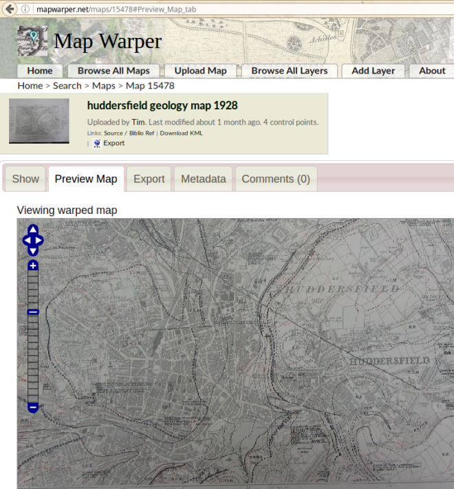
The good librarians in Huddersfield Library got digging and showed me their mining collection – including some historical maps from the 19th century, and a great geological map. I took a photo of these, and georeferenced them on mapwarper.net
For historical mine and shaft locations I consulted the National Coal Board website which shows these points. Most of the shaft locations were on the historical map. Some locations of mines were not on either maps – for example the Newtown Mill had a coal mine but was never shown. These missing mines were actually the subject for the walk – the time when the Ordnance Survey was doing its main mapping was around the same time as the first recordings of mines – the First Coal Act of 1842.
I then used UMap to make a couple of maps for the walk:
It was during the Maps day at Heritage Quay in January that I saw Roger Lynch talk about the Great Mining Map and about mines in Kirklees. What struck me was that the nature of mines in this area was very different than elsewhere. When you think about coal mining what comes into your head are probably pictures of mining towns, strikes, big pits, large winch towers, mining communities and all the other local heavy industry. Here in Kirklees, the situation was much different. Because its to the west and is closer to the Pennines, the coal strata comes closer to the surface here. It’s easier to dig up. Mines occurred all over and people travelled from village and towns and did a bit of mining here and there. Mines were smaller, and didn’t last long. Most mines were called “day pits” meaning that they were mined during daylight hours and not that they lasted a day! They were either simple shallow bell pits or drift (there’s that derive connection) mines dug horizontally into a slope.
In some parts of the town of Huddersfield the coal seams were a foot down, elsewhere they were 10ft or 40ft – quite shallow compared with the larger mines.
These simple older style mines were less advanced, technologically than the larger ones. They would put young boys and girls down these mines. They were smaller and weighed less for the small seams and shafts. They didn’t even have ponies or steam winches in the region – there was no need.
The child labour was one of the reasons leading to the First Coal Act – where it was forbidden for miners to employ all girls whatever their age and all boys under 10. There were stories of children shabbily dressed, almost naked, and stories of mothers raising their babies underground. Mining children were described as being more feral than children who worked in mills and in industry.
Around the same time as children were being saved from mining was a change in how mining in Huddersfield worked. The town of Huddersfield belonged to and was controlled by the Ramsden family. The town, in the middle of the industrial revolution, was growing rapidly. shallow surface mines everywhere were often leading to subsidence and collapses. Ramsden decided that buildings were more profitable and better long term investment than mines. Mining was banned inside of a half mile radius and restricted for another 1/2 mile outside of it. Special rules were introduced, for example to leave enough coal under the Leeds Road and the Canal nearby – to take only 50% of the coal found there.
The walk
We walked along a few mining seams, had a look at the location of a drift mine, and visited the locations of the mines at Grove Pit, The Lane Mine and the Newtown Mill Mine. We also stopped at the top of the Hard Bed Coal seam very near the venue door, at the valley slope by the narrow canal on the university campus.
Dowsing rods.
I brought along some copper dowsing rods and I encouraged people to have a go at using them before and during the walk. We would use the rods to find coal.
Dowsing over Grove Pit by the Stadium
The use of dowsing rods, at least little that I have gathered is that there are three main theories: Firstly that a mysterious outside force moves the rod, secondly that your body moves the rods unconsciously (the ideomotor effect) and therefore can detect water, coal, magnetic fields, etc, and thirdly that you are psychic and the rods are merely a tool to indicate certain things. I favour the second of these explanations, and told the participants that!
Indeed, I encouraged them to look at the coal and consciously make the rods move. Then move over the coal and then allow your unconscious to do it. I think several people were able to see how that worked.
The walk continued…
At each location I placed a piece of coal and we all stood around it and looked at it for 60 seconds in silence. We then left that piece of coal in the place. It both brought back some of the lost history, evoked the raw material, and was a different kind of activity on a walk! At one location – the Lane Mine – a site of several pits – and on Diamond Street (diamond is carbon is coal!) – we encountered a phoenix and a song bird.
It was sublime.
I had worried before the walk about how to make it psychogeographic – in the end it was more local history walk – but I had thought about doing dances, or collaboratively making a song.
Dancing – during our bio-break at the pub, I discussed this and asked the group if there was a coal dance – by good luck, John Billingsley, the editor of Northern Earth was in the walk, and he said that the rappers – the dancing with metal sword type of folk dance – was thought to have originated from coal miners – the swords are actually tools used to mine.
Looking at some rappers on YouTube – I was struck by how close the dancers got to each other, and how physcial and joined together they were, and how more energetic it was (compared to any variety of Morris dancing, for example). I would think that coal miners had to be as comfortable in physical and personal spaces. It could be said to be a claustrophobic dance style?
Phil Wood – Ghost Trails of Diaspora
We were late getting back from the mines walk, and I missed the beginning of Phil’s talk. Phil talked about some of the coincidences with places and people and families and Huddersfield. He framed the stories based on the locations he has been to over the years.
The stories were primarily about immigrant communities to Huddersfield. The location of Clare Hill and Cambridge Road featured prominently, again here! That area was where these communities first started out.
Tina Richardson – Town and Gown: The Studentification of Urban Space
Tina gave an interesting talk – view the slides and documentation here – about how private (as opposed to those provided by a university) halls of residence were changing how students used urban space and how urban spaces of the town and gown were changing.
Private halls are marketed to students much like an product is to any group. Tina looked at a range of halls in the region and beyond, and analysed the marketing material. Some interesting observations were that private halls were not a “party hostel” rather a place of serious value for money.
Clients were viewed as being co-opted into doing their bit – to making the community.
One imagines that this means that students living there were expected not to make a noise, have parties all the time, and make the most of their investment. Indeed it seemed as if, compared to when I went to University, a private halls of residence is aimed at those students who want to get maximum luxury, safety, and value for money for their investment in their studies.
Tim Waters – Getting Lost on Purpose
I did another walk – originally called “Algorithmic Walking” and changed to “Getting Lost on Purpose”. That’s four hours of leading a walk in one day! The plan was for this walk to be about a quarter in a workshop and the rest walking and relaxing. As organizers we expected people to be dipping in and out of events and hanging out in the space. We were not ready for both the numbers and the eagerness of participants. We didn’t have much on the way of a workshop, and no discussion of the theory or what I expected walkers to expect on it. As it happened then, this walk took me by surprise – and I thought I reacted badly to it towards the end – and I’ll give some ideas about why later on in this section.
As I wrote in the beginning of the post – walking around could be done in a kind of random or algorithmic way. The theory is that we can experience a place more consciously than just being drawn this way and that by the attractions and anxieties of a space. I was hoping that the walk would be a more active consideration of the areas we were walking and more active consideration about how we walk, and about how we react to the areas.
On the day, we had over twice as much people turn up, and we had to split into two groups. The instructions, without the above theory explained, were changed. This change led to a change in what I expected. Anyhow, the instruction was as followed: “The aim is to come up with ideas and methods for getting lost. I’ve got some props here, a dice, dowsing rods, compass, a street map to give you some inspiration. Grab a sheet of paper and a pencil and write one or a few ideas about how to get lost. For example you might throw the dice and if it’s 1 you go north, or you might follow your smell, or you might want people to look for a colour etc”. After a few minutes people made several ideas. We shuffled them up, and devised a way so that every 5 minutes we chose and changed the idea. Here are a couple of photos of some of the ideas people wrote:
The walk
I led my group with Alex being the Reader of The Ideas. We walked to and ended up at…YES Clare Hill and Cambridge Road!
Some of our ideas were, if I remember correctly:
Follow the rise of the land and find a lookout spot
We went up the hill to the market
Follow places of worship
We went from Temple of Consumerism / shopping mall to the parish church
Navigate using natural phenomenon
We generally stressed out some pigeons before following a high flying crow
We had a couple of following colour rules – stop at red, and turn at blue for example
You are being chased by a beast! Run away
We fled from the beast market towards the jaws of another beast – a huge jaguar statue (outside car shop)
Follow someone
We followed two lads as they weaved their way across the main roads and ring road to Lidl supermarket, then we went up a hill following someone else
Spin around in a circle and follow the direction of where they stagger off to
Head in the direction of the nearest pub
Follow the stars
Plants growing inside a showroom under the arches of the railway
The other group had an interesting encounter with a local artist: Jake Mangel Wurzel.
This led to one of the younger participants, having a Wimpy for the first time in her life, as, with her dad they got separated from the rest of the group! She liked it.
The powers of the nice and the attractive are very strong. It was very hard to make sure the group stayed together especially a large group in an urban area trying to get lost. People are social and liked chatting to each other. Some walkers tend to dawdle and drift, and some are more active in their participation. Those at the front of the group may be running off following the idea, but those at the back may be unaware a new algorithm had been chosen.
I did struggle to ensure that the group remained together. In retrospect the group was too big – a couple of times we had to stop and wait for those behind to catch up because they were a bit slower crossing the road, and a couple of times we had to ensure that those who ran off ahead were brought back – towards the end I had turned myself into a kind of crowd control / lolly pop lady rather than another participant!
Our group’s walk finished in Cambridge Road. Again. As we were walking up one participant marvelled at how he, when he was himself an immigrant to the town, stayed in that hotel for a day!
We were going to make our way back to the venue and had one last idea to follow – follow the star or the nearest pub. The group split, those following the rule ran down the hill and some others were waylaid by a furry flower on a tree in someone’s garden:
Getting Lost and Lessons Found
The owner of the house came out. He was a fellow academic and local historian and eventually offered to lead the people in for a tour of his house. Half of my group disappeared. They properly got lost! The other half who were following the stars and went down the hill eventually sent a scout to came back up the hill to look for everyone! This combined situation I didn’t handle well, and I think that the tiredness after 4 hours of walking may have contributed: I felt responsible for those taking part, I felt responsible for making sure the group stayed together, and I wanted those taking part to be actively following the rule – even if it meant saying “no” to an interesting attractive house, and also I thought it significant that those who spend 15 minutes at the house chose to stop taking part on the actual walk. But it wasn’t their fault – they were not given the briefing session on the theory, nor were they instructed to be actively resisting attraction and instead aiming for following the algorithms. Indeed, those who got lost by the house actually completed the stated aim of the walk – To Get Lost! – so people followed the rules of the walk after all! They also enjoyed themselves and had a unique experience which was literally at the high point – the peak of the walk!! Lessons learnt – in the future I will be more flexible with divergences, there should be smaller groups, participants should know the rules of the walk beforehand and perhaps everyone should have some part in the walk, like having to read out the ideas, or timing them, or documenting them etc. In reflection, many of the ideas or algorithms, because they were interpreted on the spot, and because they were often deliberately open to interpretation were affected by our tendency towards the nice and away from bad. I think we saw some anxiety in one part, for example as the rules took us into a park where The Town Youth were hanging out. I can bet you that in a drift we wouldn’t have gone into that area.
Everyone – Any other Business.
The Congress was officially ended, with the decision taken to do another Fourth World Congress next year, with the Motion of No Confidence and formal Dis-Assembly of the 4th World Congress of Psychogeography, including any expulsions, unresignations and votes.
We hope to do another Fourth World Congress in 2017!
The New Cloud Atlas, (newcloudatlas.org) is a global effort to map each data place that makes up the cloud in an open and accountable way. It’s a project to find and map each warehouse data centre, each internet exchange, each connecting cable and switch. Anything of any physical significance in the operation of the cloud should be observed in some way, and recorded for everyone to see and use. Data is stored in OpenStreetMap and users can map things using the on site iD editor with custom telecoms presets for the first time. Map tiles with two styles have been produced and have now made visible this hidden infrastructure. http://newcloudatlas.org
The New Cloud Atlas, named after the nineteenth collaborative scientific data collection project, is about understanding and making visible the hidden “Cloud”. Although most of these telecoms features are in the open and in plain sight, many are missing from open datasets or may be considered sensitive. Telecoms infrastructure has immense importance in connectivity and power in our connected world – the more connected a place is the more benefits it has. Indeed the lines of fibre optic backbone have become the new ley lines of the 21st Century powering the forces behind a new Psychogeography of places.
A bit about the name: The First Cloud Atlas was published in 1896 by the Permanent Committee of the first International Meterological Congress. Cloud weather observatories around the world were able to share consistent observations of the clouds and observe weather systems whose scale stretched over national boundaries. The publication of the International Cloud Atlas represented a move beyond national concerns and boundaries to an international perspective.
In addition to its important role in the predicting the weather, the vision is a surprisingly early call for infrastructural globalism and worldwide collaboration:
“If there be any branch of science in which work on a uniform system can be especially useful and advantageous, that branch is the inquiry into laws of weather, which, from its very nature, can only be prosecuted with a hope of success by means of very extensive observations embracing large areas, in fact, we might almost say, extending over the whole surface of the globe”
Site
The site shows frequently updated tiles generated from OpenStreetMap(OSM) data, details about the project and a custom OSM editor for making it easier to add map features. Here are some screenshots.
Map, Transparent Tiles, Markers, Legend
Cloud X-Ray Style, with scale independent(ish) building polygons
The Cloud X-Ray style, shown above was partially inspired by Kosmtik’s data inspector style, and it shows polygons that are enlarged at low zooms. Polygons should appear to be the same size on the screen as you zoom in. It gives a sci-fi cartography, but I find it very useful finding clusters of mapped features, as all features are shown at all zoom levels.
The New Cloud Atlas is a project initiated by experimental media technologist, artist and designer Ben Dalton with the design and research studio of Amber Frid-Jimenez and Joe Dahmen, and myself. Ben writes about the project – with the main idea that it’s about understanding what the Internet actually is in physical terms, rather than as something that remains clouded and mysterious:
The first appearance of the internet cloud was in network diagrams. The cloud symbol was used to stand in for complexity. The cloud embodied something of the way that the internet functions. The internet was designed to be ‘end-to-end’, so computers are meant to be able to connect to each other without interference as the message passes through a network of interconnections. Only the end points are meant to matter. The clouds here represent ‘something in the middle that is too complex to draw here’, a kind of neutral space through which information passes. It is an act of simplification, but it also contains an implicit statement that ‘the cloud will look after itself’ that this thing is going to carry on being there.
Beclouding is deliberately making something more confusing, in order to obfuscate or conceal its meaning. The use of the cloud has shifted in digital systems. The idea that ‘this is too complicated to think about’ has been moved front and centre and converted into a business model, shedding its innocence along the way. Through a sleight of hand, the cloud sometimes appears as a platform, and sometimes a material. This narrative rests on the idea that the services are to be trusted, and they can take care of themselves on your behalf. We trust them with our emails and our childhood photographs and our meeting plans and whatever else we use the cloud for. In this new definition of the cloud, there is a statement that ‘this is too complex to deconstruct or critique’. You shouldn’t try to look in to the cloud and see what’s there. It’s made up of vapour, and it’s not to be interrogated. Better to simply observe it from a distance and admire it at sunset.
Once the domain of national governments, information infrastructure is increasingly constructed, operated, and maintained by major multinational corporations. These corporations, which include Google, Facebook, Amazon, Apple, and Microsoft, have a similar vested interest in maintaining control over of the flow of goods and information once exercised by national governments, but a reach at once more extensive and less transparent.
Psychogeography
Regular readers may know of my interest in Psychogeography. The British Psychogeography of the 90s employed Ley Lines and “Magico-Marxism” using the language of the occult to explain the unknown forces of power at work in space and in places. I’m developing the idea that the new lines of power in the 21st Century are of Information – and the actual lines of light that transmit these bits of data, and the buildings that house them. More about that in walk or talk later on this year!
Another more obvious connection with psychogeography is the hidden in plain sight angle. These passageways of the internet are often marked, on manhole covers, in mobile phone masts, in big buildings in light industrial estates, but they are utterly overlooked. They may travel along the margins, along canals or train tracks. They are also sited in classic psychogeographical “liminal” spaces – beaches, margins of rural and urban, wasteland, on top of tower buildings etc.
OpenStreetMap and the Telecoms WikiProject
OpenStreetMap allows anything that exists and can be verified to be mapped. There is no notability rule that Wikipedia has, for example. So it allows manhole covers to be mapped in detail, it allows telephone lines and the assorted street cabinet boxes that crowd our pavements. You might get feedback as to how to map these features and you might get funny comments about why these features are being mapped (and indeed, mapping with OpenStreetMap is voluntary!) but pretty much all OSM mappers will agree that these features shouldn’t be excluded.
Telecoms features in OpenStreetMap haven’t been well mapped before. This is both good and bad in that the taxonomy (or folksonomy to be more accurate) – the tags that describe these features -have not been standardized. We have the opportunity to define the tags, or at least standardize some of them to be more consistent across similar telecoms infrastructure features.
The current features being rendered in the New Cloud Atlas map are:
Data Centres
Telephone Exchanges
Manhole covers
Telephone poles and wires
Submarine cables etc
Telecoms towers, masts, and antennae
Street Cabinets
Underground features may be more difficult to map – so we are relying on manhole covers which often show what its use and who operates the cable underneath (in the UK at least) – and those markings sprayed by utility companies, and some data imports. If you don’t know where an underground cable goes its probably best to leave it out.
You might have noticed that many of the options include sound and heat for the street cabinets. One of the side effects of today’s modern fibre optic street cabinets is that they are often installed with more power needs than copper wire ones – and so they need a fan. Often the cabinets are warm to the touch and sometimes they make a quite loud drone sound. This type of data can be useful, I have heard, to people who are vision impaired. Sound and touch can help orientate people in space.
It’s probably worth talking a little bit about the privacy and secrecy issues. Although the project isn’t about getting releases of data from companies and governments, and it’s not about uncovering the secret installations, it is about collaboratively mapping the world. Almost all of the information that will make up the New Cloud Atlas will be found in the field or in public information sources.
You may be reminded of a story in 2003 (2 years after 9/11) of Sean Gorman‘s PhD dissertation that the US Government wanted to make classified as although it contained only publicly available information (about the Internet connections in the US) he analyzed the data to identify the weak links – weaknesses that, for example, a disaster could take out or a terrorist could exploit. Officials in the US Govt said that his dissertation should be burnt! Sean successfully graduated and started a mapping company with the DHS as clients. (I actually ended up working there at FortiusOne / GeoIQ several years after that for a bit). Now of course open data and open analysis is encouraged and promoted by governments (and following this trend check out Sean’s new startup Timbr.io).
You may also recall stories about how many national mapping agencies removed military bases (such as Aldermaston, or Greenham Common in the UK) from their paper maps – even when these bases were signed from the motorways and major roads and had nice big clear signs outside the fences. A relic from the Cold War, perhaps. It appears to me that even in this current year the Ordnance Survey mislabels the Menwith Hill USAF/RAF Listening Base in North Yorkshire as just “Menwith Camp” with no indication of it’s real name, activity nor landuse (as compared to OpenStreetMap for example).
At this point, if you are curious, we should evoke the classic 1996 Wired Article by Neal Stephenson: Mother Earth Mother Boardhttp://www.wired.com/1996/12/ffglass/ It’s essential if you are interested in reading more about the geo political and technology of international internet cable laying. It’s also a great read in general.
Of possible interest to mapnik style geeks could be the use of the scale denominator and PostGIS ST_Scale commands to scale up building polygons so that they appear to be the same size regardless of the zoom. If anyone wants to fix this to make it work better, please let me know!
select st_translate(st_scale(way, (!scale_denominator! * 0.00028) - (5 - z(!scale_denominator!)) ,
 (!scale_denominator! * 0.00028) - (5 - z(!scale_denominator!)) ),
st_x(st_centroid(way))*(1-( (!scale_denominator! * 0.00028) - (5 - z(!scale_denominator!)) )),
st_y(st_centroid(way))*(1-( (!scale_denominator! * 0.00028) - (5 - z(!scale_denominator!)) ))) as way,
 building AS type FROM planet_osm_polygon WHERE (building='data_center' ) AS data",
OSM Tile Generation
Tiles are kept up to date at around 15 minutes with the central OSM database. Occasionally a full planet import is done. I think I could use Lua scripting to ensure that the database remains lean. The system uses TileStache to enable the UTFGrids for the popups. Essentially we filter out a lot of stuff from the OSM database:
Last autumn I popped up to Edinburgh from the North of England for State of the Map Scotland conference. Together with Edinburgh College of Art in Evolution House participants took part in series of workshops “Map.Makars”
I took part in a memory map of the city. The rules were: no looking at other maps, the map should include the venue, the castle, the train station. We drew, from memory the city on large pieces of paper. Gregory scanned/photographed these and put these on mapwarper.net to stretch them to fit. he then combined these together with an interactive and animated transparency control to create the Hand Drawn Map Collider “No-map Map“ Give it a whirl! http://www.livingwithdragons.com/maps/nomap-map/
My map, in case you were wondering was possibly the least accurate of them, coming from furthest away! http://mapwarper.net/maps/10907
The next few posts will cover some pet projects that I did whilst not being able to work due to recent civic duty. They cover things from the role of familiar strangers on the internet and anti-social networks, through to meteorological hacks, funny memes to twitter bots. The first in this series is about what happens when you use markov chains and radical texts with twitter.
Detournement is a technique now considered to the father of remixes or mashups, but with a satirical political nature. Have a look at the wikipedia entry for detournement if you want to know more about it. Basically you do something to something which twists or re routes it so that it makes new meanings. It was the Situationists, led by Debord who really adopted and ran with this as a practice.
Debord would often frequently plagiarise other radical texts in his own work. (The Situationists were also the ones behind original notion of psychogeography – something that you may have caught me talking about before.)
So what would happen if we could detourn, or mashup, or plagiarise Debord’s own writings? And how about if we could publish it periodically, and how about if we had a 140 character limit? Yeah so this is my experiments with these ideas.
Bruna Rizzi; it is from this disastrous exaggeration. The peasant class could not recognize the practical change of products
The proletariat is objectively reinforced by the progressive disappearance of the globe as the bureaucracy can
Markov chains basically work like take a couple of sentences: “A lazy dog likes cheese” and “My house likes to be clean” then look at groups of two or three words together. Then if one of these groups share the same word (“likes”), make a new sentence using that word to chain together. “My house likes cheese” or “A lazy dog likes to be clean”. Markov chains result in sentences that look human readable. The more sentences you feed the population sample, the better or more varied the same of generated sentences.
Some radical texts are complete nonsense and really hard to read, so perhaps applying Markov chains to them can help reveal what truths the obscure language hide.
My solution uses Ruby, the Twitter gem and the marky_markov gem.
https://github.com/timwaters/rattoo is the work in progress twitter bot – it works currently on Heroku using the scheduler to periodically tweet a sentence, see if any other users have asked it questions and reply back to them.
A map can represent the physical structures of which a city is at any one time composed, but the city itself remains uncharted. This is not only because the city will have changed materially by the time the map appears. A map cannot contain the infinite places that the city contains, which come and go along with the people who pass through them. The map is an abstraction, simplifying experiences that are incomparably more variegated.
This weekend there was a data hackday at the UK’s NHS Information Centre for Health and Social Care in the centre of Leeds.
There’s a wealth of data on their website , but it was given to us as a mysql database, and we were able to enter remotely. On the first day I poked around the data and had a thought.
Hackdays
I often spend the first part of any hackday wondering what to do, and twiddling thumbs. I find that hackdays become for me a type of busman’s holiday – and this hackday was particularly geographical in nature. Most of the entries had some kind of data on map component. I think that these types of analyses, whilst being very smart and interesting – and may be exactly what the judges are looking for, may not exactly stretch the unexpected or “the hack” in the data.
Fortunately there was plenty of latitude for exploring things laterally. The most interesting dataset was listing the chemicals and drugs each practice spent money on – but I couldn’t find much to do with it. What caught my eye was the dataset listing the names of the doctors surgeries, practices, medical centres. If I think about my neighbourhood I can pass about half a dozen doctors in a very small area. Leeds is well covered (or perhaps just my area is!) . I was reminded of James Joyce’s quote about being unable to cross Dublin without passing a pub. Perhaps the same can be said for Leeds and doctors! The names of the surgeries were also interesting. Names such as:
Chapeloak Surgery
The Avenue Surgery
Dr Ca Hicks’ Practice
The Dekeyser Group Practice
The Highfield Medical Centre
Chapeltown Family Surgery
Wonder if the more “leafy” the name, the more “leafy” the neighbourhood it was in? Perhaps the more grandiose sounding practices had more patients? Perhaps the smaller sounding ones had better patient satisfaction reviews?
At the venue, it appeared that I was the only one to be using Linux on the desktop and so the wifi did not work – so I had a bit over one hour to put something together. Decided to go with the concept of “Leeds is covered” and wanted something showing the labels of the practices over the areas where they were. Filling out the map, so to speak. The hack was called “Tim’s One Hour Data Challenge” and here is the end result:


 I brought along some copper dowsing rods and I encouraged people to have a go at using them before and during the walk. We would use the rods to find coal.
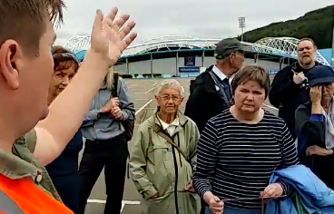


 Private halls are marketed to students much like an product is to any group. Tina looked at a range of halls in the region and beyond, and analysed the marketing material. Some interesting observations were that private halls were not a “party hostel” rather a place of serious value for money.