LeedsAdultLearning.co.uk

This year, with Leeds City Council I developed LeedsAdultLearning.co.uk which is a course finder for about 300 courses by the City and run by a number of providers and dozens of venues. It offers a range of first step courses for adults, such as basic IT skills, ESOL, caring and crafts. Within the first 24 hours of launch it received over 3000 visits, in the first month, it had over 25,000 visits, with the average user spending three minutes on the site.  The code’s up on my LearningInLeeds GitHub repository.

Screenshot-2017-11-22 Find courses near you in Leeds - Adult Learning in Leeds

The project evolved from a LCC Innovation Lab – similar to the Leodis project I also worked on. The key idea is that it was designed to be a pilot or prototype project, small in scope and quick to develop, it would aim to be an aspirational example of how the City can work with the Council and open data to make good IT products. The adult education department were fully engaged with the development and design of the project, giving feedback, priorities. This engagement was really welcome and I think the experts say its crucial to any successful agile project. The department didn’t have any online course finder before so this was bringing something new, and needed to them.

Screenshot-2017-11-22 Accredited Courses at Swarthmore College - Adult Learning in Leeds

It was featured in the Government Technology News site, the Yorkshire Evening Post, on Made in Leeds TV, and was shown on the big screen in Millennium Square.

Screenshot_2017-11-22_13-45-10

Features

  • Automatic imports of courses from Data Mill North (open data site)
  • Full text search with support for sounds like and spelling mistakes
  • Geographical, near searches
  • Bus and walking directions to the start of the course from any point
  • Add to calendar links for course start
  • Showing courses by topics or categories
  • Responsive and mobile friendly.
  • Simple CMS admin UI for staff to update text pages, change records etc
  • Caching of external API requests, front page and CMS pages
  • Recent searches kept

Technology

  • Ruby on Rails
  • Devise and Active Admin for admin UI
  • Postgresql, PostGIS and pg_search for db, geo, full text stuff
  • Bootstrap for front end user interface layout, CSS etc
  • Transport API, Bing Transit, Mapzen for journey planning and geocoding etc

Future

The project could be altered for other organisations, and it could be altered to include the whole range of courses on offer for adults across the city region. I think usage metrics would need to be done to see what users actually do on the site, and whether the journey planning is useful. Adding extra information about course duration,  how many times a week / month etc would be good. Making it more mobile friendly could be looked at, including making a mobile only app.

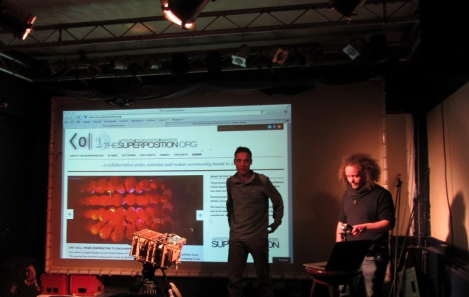
Magic, Illusion, Perception @ March Leeds Superpositon

A few days ago saw the most recent meeting of the Superposition group in Leeds. That nights was under the theme “Magic Illusion and Perception”   I’ve pinched a lot of the text in this post from that one!

There were four talks. The first was about the “curiosity” machine that uses lasers to draw moving images on clouds, the zoopraxiscope, and it was taken up in a small plane where images of a moving horse were projected onto a cloud. Wonderful stuff.

IMG_1792

Ben Dalton’s talk ‘Zines in the age of ‘big data’?’ introduced and proposed the idea of bundle publishing. At odds with current trends in digital distribution, bundle publishing involves editing a large collection of digital content and then publishing it on a specific date as a single, large file. This was the most intriguing talk of the evening, where instead of streams, or blogs, or things, that media could be published and shared in huge bundles of files. I’m encouraged partly by online publications such as The New Inquiry as an alternative to a blog roll. Ben is also interested in pseudonyms. A team of writers may publish using the same pseudonym – the pseudonym would have its own character, style of writing. There was also the pseudonyms as used by “anon” users – names that become used and familiar to people.

Experimental jazz musician and neuroscientist Christophe de Bézenac talked about the blurring of self and other in music and psychosis. Having studied at Conservatoire de Strasbourg, and been a regular performer at international music festivals he explained how perceptual ideas have guided his musical practice and how his musical work has, in turn, fed into his empirical/neuroscience research into psychosis. This talk really excited the audience, with discussions about what is ambiguity. Ambiguous language, music etc. What is the crowd? What is the mob? Can someone experience things as a group? Fascinating stuff.

IMG_1794

Professional Magician and Slight-of-Hand artist, Tony O’Neill discussed his creative process within the magical syllabus and sharing his current findings on the power of suggestion and self belief. It showed that magic, fortune telling could be used to help people, even when they knew what the process was all about. I wonder if a city needs more magicians, or if this type of magic could be used on a group of people. Things discussed include things like you can change someone’s mind by planting suggestions, etc.

IMG_1797

Sticks & Booze – Beating the Bounds in Headingley

About 25 people turned up for a Beating the Bounds psychogeographical walk around the Headingley (Leeds, UK) DPPO Boundary.  It was run by me and the Leeds Psychgeography Group. Tina runs and blogs about the group, and there’s a Leeds Psychogeography Group Facebook Page to boot.  All photos here were taken by Mark Jaffé, cheers!

A DPPO stands for a Designated Public Place Order. Essentially within that area, if you are causing a nuisance or annoyance, a police constable can stop you drinking, confiscate booze, up end cans etc. If you don’t comply then that is when you may be breaking the law. It’s a law to stop street drinkers mainly. In the Hyde Park and Woodhouse DPPO area, well over 80%  (over 300 in a few months) of people stopped, were students. Phil Kirby went on the first of the Beating the Bounds walks, and has blogged about it on The Culture Vulture.

We were to talk widdershins, anti-clockwise around the boundary – a magical act, designed to disperse any energies or what have you. I brought along some sticks (loop cane, chopped in half) for people to beat the ground at certain points. Oh, and we drank as we went – essentially beating the restrictions.

We passed through some nice areas – here on the ridge, was the Wassailing tree. We also encountered the strangest plot of land in Headingley, fish and chips and had assorted adventutres.

Games developed, whereby when a DPPO warning sign was found, a drink had to be taken.

It took about 2 hours. I was quite tipsy at the end. in the above picture, we can see a stick being used in it’s traditional role of beating a boy.

I’ll be doing some more psychgeography posts in time. The next beating the bounds walk will go around the city centre – it’s a huge area!

just some words

Before a few posts about Psychogeography in Leeds here are some nice words:

geo-tagging
guided walks
volunteered geographic information
ephemeral cities
social history
short cuts
psychology
imaginary urbanism
altered maps/radical cartography
travel writing
psychogeography
marxism
place based photo blogging
urban exploration
site specific sculpture
land/earth art
neogeography
old maps
architecture
situationism
hauntings
green space
performance art

mainly ripped off from neogeography.net

Tracks in Time – Tithe Maps for Leeds

Popped along to the official launch of West Yorkshire Archive Service’s (WYAS) Tracks in Time website and their new online mapping application, held at the City Museum. Earlier the prototype was leaked onto Secret Leeds to an enthusiastic response. I’d always been interested in this project, having been made aware of it when I was asked for some advice about it in the very early days of the project, by me living in Leeds, and recently with our work with the New York Public Library georectifiying and digitizing their historical map collection – so it’s really good to see it out there and completed!

Its a nice application (even if it has a bit of an old fashioned/council GIS feel to it) and works well, that used the code from a similar Cheshire Project.  The project is the culmination of some Lottery funding and although the Archive service is for the whole of the county, the project was restricted to Leeds. Gardline Infotech were contracted to do the offline GIS portion, and the folks at WYAS, with Leeds City Council and Cheshire Shared Services who put together the online version.

The system has two map panes, on the left tithe maps and on the right some more modern reference maps.

leed tithe map application

There is also  layers for land use and who owns what. Users can search for people and get these selected on the map – it’s a great resource. Searches can be exported as CSV file, which gets marks from me. Unfortunately, both these exports and the maps miss out the land value data, which had been transcribed, apparently due to a technical limitation in the software, which is a great great shame. I’d love to be able to compare the price of land as it was then to house prices now.

I think it was Stephanie? from WYAS, who was describing how it was not only people that can be searched, but corporations or other owners. A search for “railway” for example gave results for all those portions of land taken for new railways. Railway companies such as Leeds & Bradford Railway Company and North & Midland Railway are recorded, with land also taken for railway stations. On the map we see that the present day lines of the railways, before the lines were built. Its a particularly good resource for that time of the industrial revolution, and is strong in the north of england where a lot of the industry was taking place.

leeds west yorkshire tithe map

The 58 hand drawn tithe maps were scanned, georeferenced and digitized. The digitized vectors were tied together with volunteer transcribed apportionment information – over 29,000 records!

The maps are hand drawn.
The maps were scanned by the Coal Authority in Nottinghamshire. They have the largest facility in its kind in Europe. Some of the maps took up the entire table – they were over 3m long!

Tithe maps were not meant to be definative maps of boundaries or for navigation, they were never meant to be a record of rights of ways and roads. As a consequence, these maps have parts where some areas are out by 60m or more. Its also important to remember that the maps are hand drawn. There were only ever 3 copies of each made – one sent to London, one to the Diocese and one to the Parish. The Archive Service had a copy of all of the maps but sometimes only one of the were found – and some were in poor shape.

We had a chat with the representative from Gardline Infotech whose name I didn’t catch and Peter Lythe, the project manager for WYAS – and discussed some of the challenges.

Georeferencing the maps proved troublesome – in particular where maps had folds and some where the original surveys were inaccurate. The side by side panes help to disguise some of the inaccuracies where they occur. They used the historical buildings data to help pin point some of the areas on the maps, and then used OS MasterMap to get the tie points. Yes, I can hear alarm bells ringing too – by using OS Master Map, the georectified maps are derivative works of Ordnance Survey, and so you’d need to have an OS license to use them.

Gardline used Cadcorp and FME mainly to vectorize the data, and they did a good job.  I don’t think the vectors can be downloaded either – if they were the digitized land parcels vector GIS files would also be under this same license. There was never a requirement to make available these files available to the public at large for free – so nothing wrong happened, just another missed opportunity. The good news is that the transcribed data is separate from the maps and can be accessed and downloaded (without the land values field) – and the scanned source imagery would be free of OS tie-in and it wouldn’t take too much to georectify the source maps (and even remaining ones for the whole county) and vectorize them in a collaborative and open manner, as we’ve seen.

Overall it’s a plus to the city and a marvelous resource of the past for the future.

Northern Mappers Meetup, Sun 25, Leeds

Behind the recent formation of Talk-gb-thenorth OpenStreetMap mailing list for the North of England. There’s the first Northern Mappers Meet-up.

Meeting 3pm at Scarborough Hotel, Leeds on Sunday 25th Jan. Details on Leeds page,

With a lot more active users, interested people and mappers up north here, we’ve started this mailing list. A place to discuss local relevant issues, announce and plan events. We hope to start a few social / say trips out events around the region in the new year. All welcome to sign up!

2nd Leeds Mapping Party with Leeds First Web Festival

In just under two weeks, on the Sunday during Barcamp, we’re having the Second Leeds Openstreetmap Mapping Party.

It’s free but sign up at the eventwax form, so we know how many people to come. GPS and instruction are provided, so newbies are more than welcome. The party is sponsored by Cloudmade.com, the “disruptive” startup founded by Nick and Steve. Cheers guys! The main organised day is Sunday, starting at 10:30, and meeting back at lunch to hand off from barcamp, with drinks and a meal in the evening but if you are around on the Saturday, you are encouraged to do some mapping too!

It’s almost a year since the first mapping party, and a lot has been done, the number of mappers in and around the city has tripled in size, and there are less blank spaces on the map. Here’s a map showing the state a year ago, and the state today.

The mapping event it also part of Leeds’ First Web Festival, snappily known as LS1.

A month of tech and web events that shows this city as being a major hub for innovation and creativity. (The first movie ever made was filmed in Leeds in 1888, and Leeds had the first traffic lights in 1928!)

New OSM animation

Way back in september, we had the Leeds mapping party, and I produced a nice animation from the traces.

Now, with some more traces, and a nice animation script here’s a new one hosted on motionbox (hoping to convert it into a flipbook… watch this space when I get one)

part.png

you can download the bigger original here:

http://geothings.net/osm/leeds/leeds_mapping_party.mp4

NEW: Got the FlipBook today from Motionbox! It is really cool

flipbook.jpg
EDIT:
http://geothings.net/osm/leeds/flipbook.mp4 for video of flipbook

just doing it up north

NorthPack was launched yesterday at Leeds geekup last night, the monthly gathering, with talks, beer etc, made by the NorthCrew, who also do the NorthCast, a podcast for the north. I think its a great idea, and am 100% behind them.

NorthPack is an ambitious project which aims to unite web related professionals based in the North of England and shine a spotlight on the Northern community, providing a showcase for talent and the great work that goes on “up North”.

Good to see some people just going out there and doing it.

BarCamp Leeds Map

Here’s a map of the registrants for BarCamp Leeds 2007, from the registration data given to me by Imran. Nice to see a wide spread of people from around the place, and, as you can see, they are mostly up North! It uses  the very good Openlayers JavaScript mapping api, and the default underlying mapping is of OpenStreetMap  but also Yahoo, and Google Hybrid map can be seen (thanks Chris for the OSM tiles!).

Looking forward to barcamping, going to do something geo, whether opensource geostack, openstreetmap, or desktop GIS stuff, who knows! Any suggestions?

(Got this up on geothings.net on the day I’ve registered it)